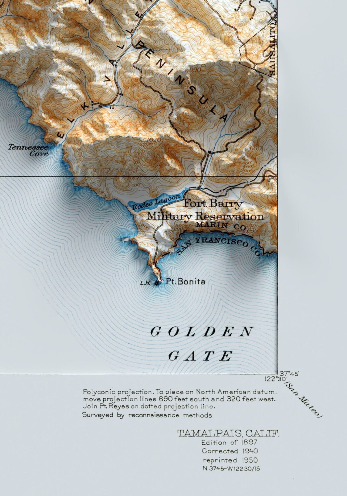
Vintage Mount Tamalpais Map Print: 1890s Shaded Topography - USA
Vintage Mount Tamalpais Map Print: 1890s Shaded Topography - USA
Couldn't load pickup availability
All orders are printed locally in your region (US, EU, UK, AU) for quick, easy delivery
Please note: this is a flat 2D print on paper. The shading creates the appearance of depth; the map is not physically raised.
Dive into the timeless elegance of our 1890s Mount Tamalpais map, enriched with the intricate details of a bygone era. This masterwork perfectly illustrates the grandeur of this iconic peak in Northern California. From its prominent summit, kissed by the dappled hues of the setting sun, to the sprawling oak woodlands that cloak its foothills, and the serpentine trails that tell tales of adventurous sojourns, every meticulous line and contour on this map transports you to the resplendent days of Mount Tamalpais in the 19th century.
Perfect for lovers of vintage cartography, history enthusiasts, or those enchanted by the age-old beauty of Mount Tamalpais, this unframed map is poised to be a distinguished testament in any ambiance. Embark on a journey through map-making artistry, where the enduring majesty of Mount Tamalpais melds with the sepia-toned romance of the 1890s.
~~ 🖼️ About the prints ~~
Step into a world of stunning landscape art with these shaded relief maps. Using LIDAR data collected from planes, satellites, and even the space shuttle, I create realistic 3D-like detail on a flat 2D art print on paper.
All of my prints are printed on high-quality matte 200gsm paper using the giclée technique to provide the most detail and best color possible.
The starting price is for an unframed print. Choose an unframed print or a black, white or wood frame from the size and framing options; framing is available only for the sizes shown. Any frame shown in the images is for illustrative purposes.
~~ 🖨️ Printing & Production ~~
I understand the importance of prompt delivery and sustainability, which is why I use printers in the UK, USA, and Europe. Your order will be printed as locally as possible to make the process more eco-friendly, and ensures that you receive your map as quickly as possible, no matter where you are in the world.
All orders are printed on demand to reduce waste and ensure that you receive a high-quality product every time. This also means that I have the flexibility to make any necessary changes or customizations to your order before printing.
~~ 🚚 Shipping ~~
Smaller orders up to A4 size will be shipped in envelopes, while larger A3+ prints will be shipped in poster tubes to ensure safe delivery.
I use local couriers such as Royal Mail for UK orders, USPS for US orders, and a variety of couriers including DPD, DHL, and local post services for European orders.
Share